.jpg)
Excited to fly your new drone? Of course you are, but first, you’ll want to make sure you have all the tools you need to fly safely. That includes the latest software not only for the drone app to control your drone, but for additional tools to enhance your flight experience as well.
Today is all about the extra apps you can install to get more out of your flight experience, these are some of the best drone apps.
1. Google Earth
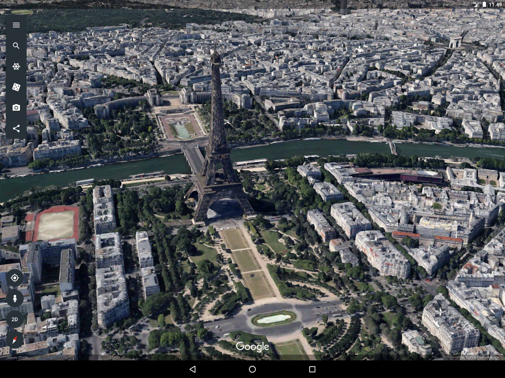
As you well know, the first thing you’re going to need to do with any drone (after registering it,) is figure out a place to fly it. Truth is, there are some drone dedicated mapping apps on our list today, they are great at showing where it is safe to fly. Safe places to fly is one thing, but before you get to that point, why not scour Google Earth to find exceptional places to fly. Google Earth is free for your mobile device and available on the web as well.
2. Airmap
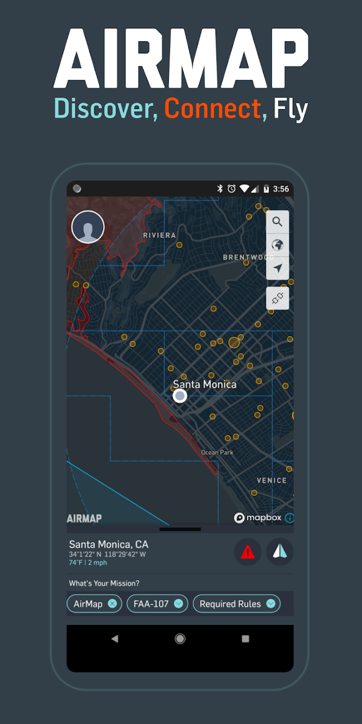
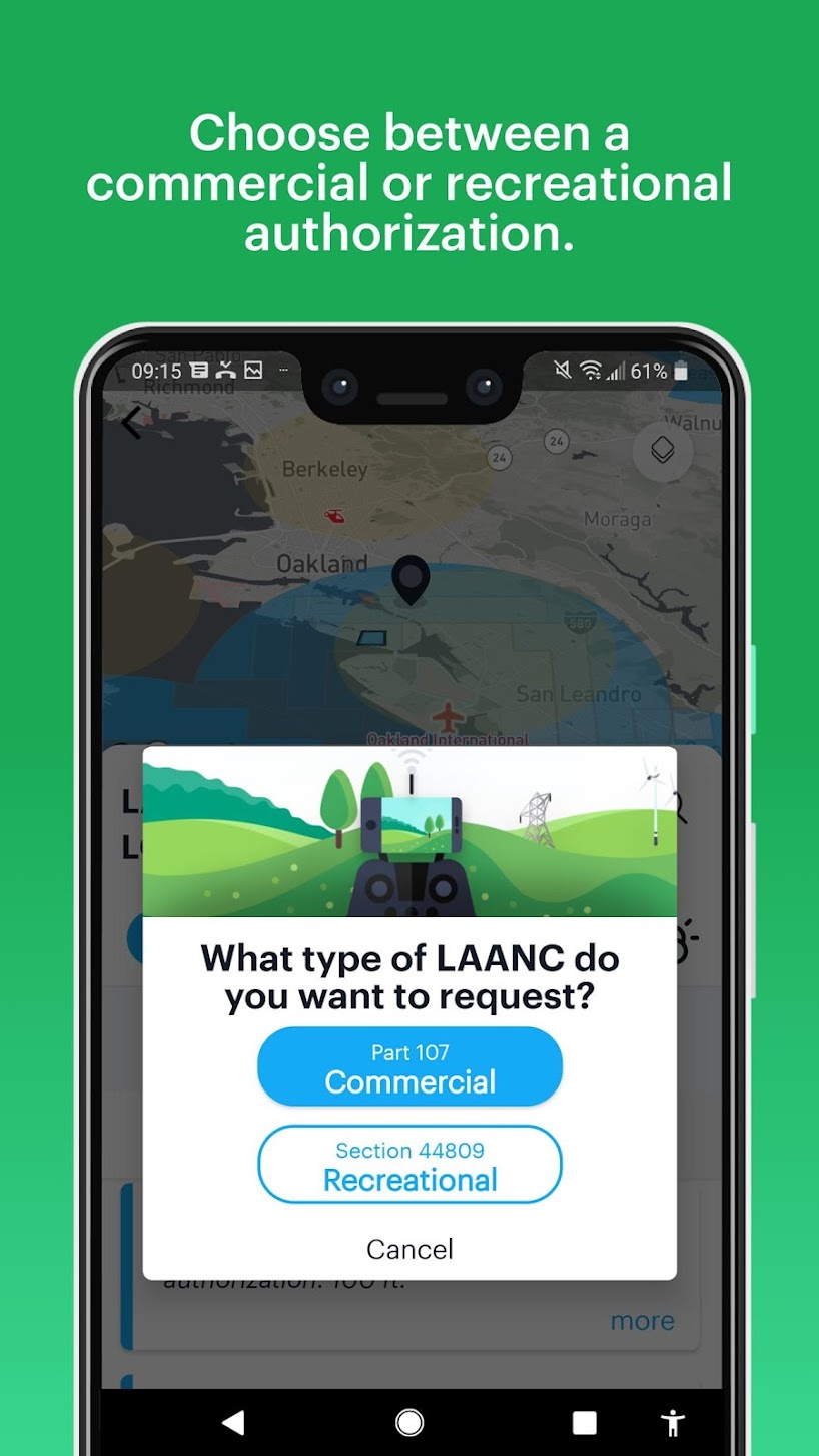
Airmap is one of those tools that does so much more than just map a potential flight location or help you keep a log of your flight. With backing by companies like Microsoft and Qualcomm, not to mention drone players like Yuneec, Airmap is rapidly becoming the de-facto tool for commercial drone flight. Don’t let their drone mapping, geo-fencing, and flight logging commercial tools scare you off, utilizing the real-time traffic alerts in their mobile app is value enough. Check out Airmap for your basic needs, or for your commercial piloting business.
3. FAA’s B4UFly
Let’s keep this super simple: the FAA is the entity that enforces drone laws in the United States, and this is their app that tells you where and when you can fly. I could stop at that, but I feel you should know that B4UFly is a little bit overbearing sometimes, telling you that you can’t fly in some places that you can. That said, the app provides one of the most detailed airport listings around, displaying the 5-mile radius of each. What it boils down to, if in doubt, the B4UFly app is how you go to the source for legal info on drone flight in the United States.
If your drone weighs 0.55lbs or more, you must register with the FAA and affix your registration number to the craft. The process is simple, but it will cost you $5 and you must be at least 13 years old. This registration will expose you to the FAA rules for drone flight, which we highly recommend you familiarize yourself with.
4. Hover
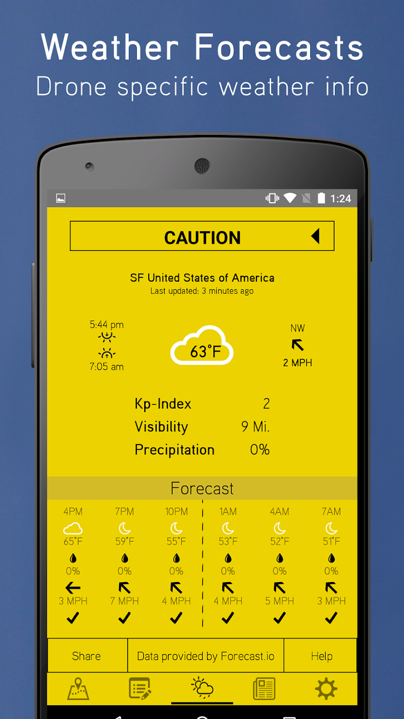
Hover is an underrated app, providing mapping and location awareness info as provided by Airmap, but then adds in weather info. At a glance, Hover can tell you if it is safe to fly. Taking visibility, wind, location, and more into consideration, Hover may not be the only drone app you need, but if you were to stick with just one, an app like this is certainly a solid bet. Grab Hover for your mobile device now.
5. DroneDeploy

Next up is an app that we hesitated at first to include. We had hoped to make a list of best drone apps that did not focus on any one vendor, truth is, DJI is such a major player, and this app is so cool, we couldn’t resist. If you own pretty near any DJI drone from the Phantom 3 and newer, take a look at DroneDeploy as an alternative controller for your flying machine. The app provides advanced flight planning and autonomous control for your drone. Select a path of coordinates and watch your drone fly the route, have the app control camera exposure on the go and much, much more. Check out DroneDeploy now.
6. UAV Forecast

Focusing almost entirely on the weather, UAV Forecast strives to provide detailed wind and weather information to help you decide if it’s safe to fly. Tell the app the parameters of your drone, it can then quickly indicate whether or not today is the day to fly. A range of piloting info is provided, including wind speed and direction, wind chill and temperature, cloud cover, visibility, and more. Not to be outdone by other apps out there, UAV Forecast also provides mapping with visible no-fly zones. Check it out for your weather needs.
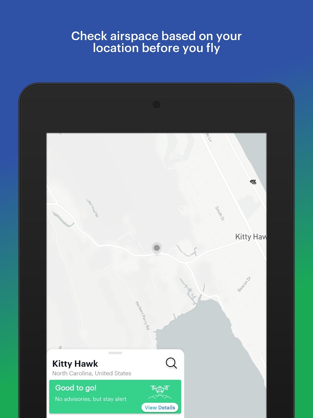
7. Kittyhawk
Let’s see, we’ve covered apps that check the weather, apps that have maps with no-fly zone listings, maps with active air traffic information, apps that keep flight logs and help you track your drones, now for one app that does all of the above. Kittyhawk: Drone Operations is a robust app and platform, including everything from pre-flight checks to post-flight analysis. Kittyhawk is an ambitious app and platform ready to get you in the air and make the most of your time in the sky.
8. Sun Surveyor (Sun & Moon)
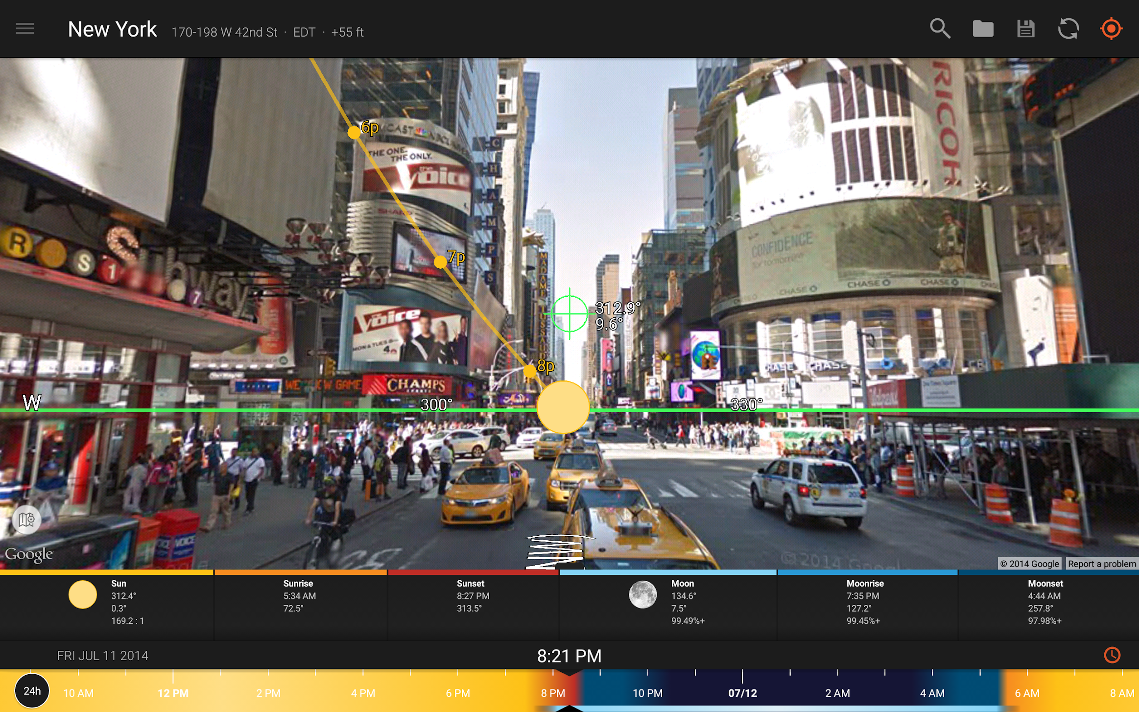
If you’ve ever been outside… I’ll just stop that right there. Outdoor photography is almost entirely a matter of managing sunlight, this is never more true than with drone photography, as there is no shade up there. Instead of guessing where the sun and moon will be, why not know for certain, Sun Surveyor does this, with great accuracy. The perfect sun or moon position is but an app away. Sun Surveyor (Sun & Moon) is $7.99 for Android.
9. Verifly
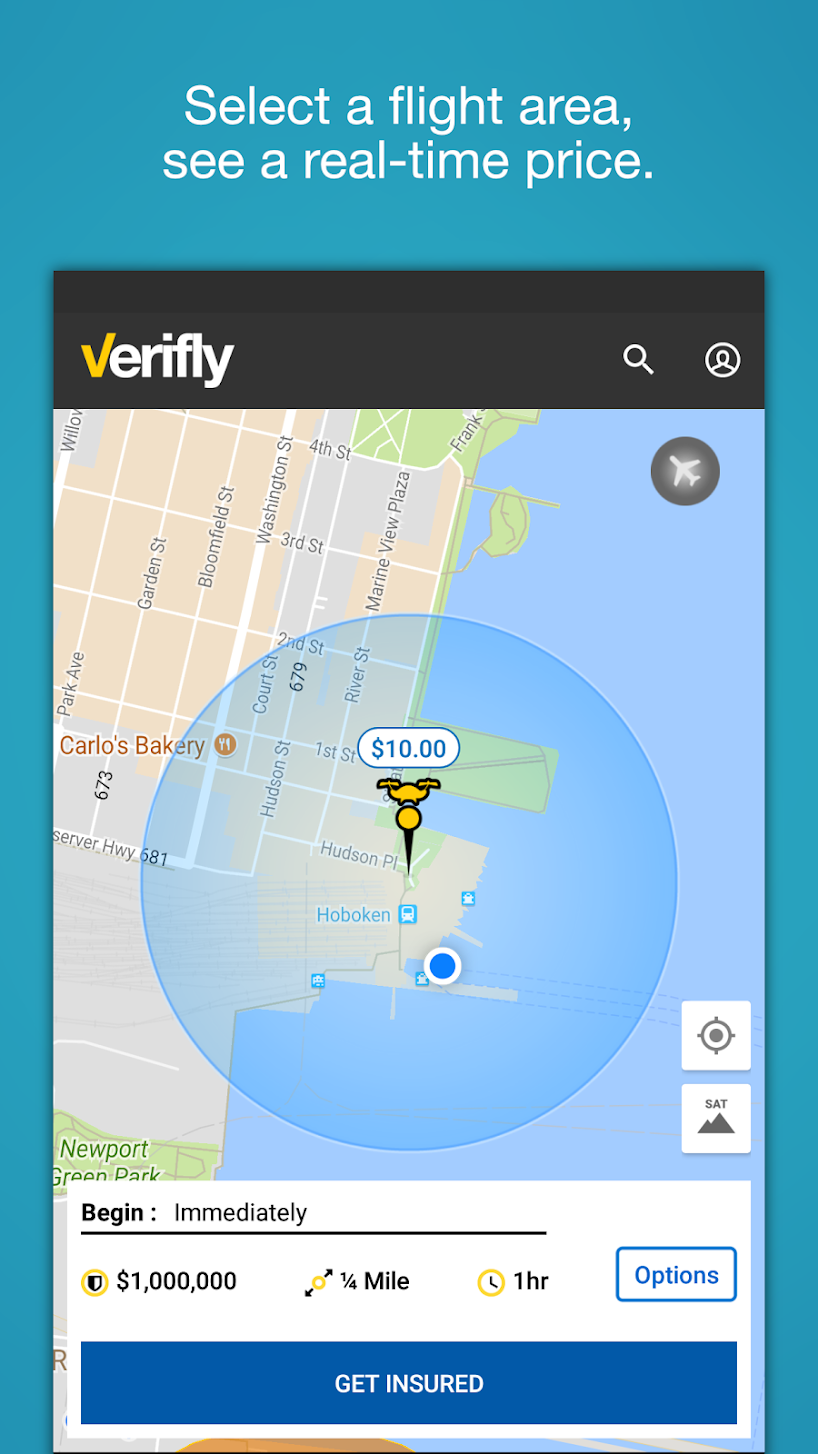
Insurance. Love it or hate it, insurance is an important part of modern-day living. Unlike your car or house insurance, which you pay a premium each month, Verifly is doing something different, insurance on demand. The idea is simple, your flights, particularly commercial operations, are either too few or too spread out and unpredictable to commit to full-time insurance coverage. Verifly allows you to log your start time and finish time, then just pay for what you use. It starts at around $10/hr. Hit the download buttons below to see more details on the actual coverage. Policies are underwritten by Global Aerospace, Inc.
10. Litchi for DJI drones (special consideration)
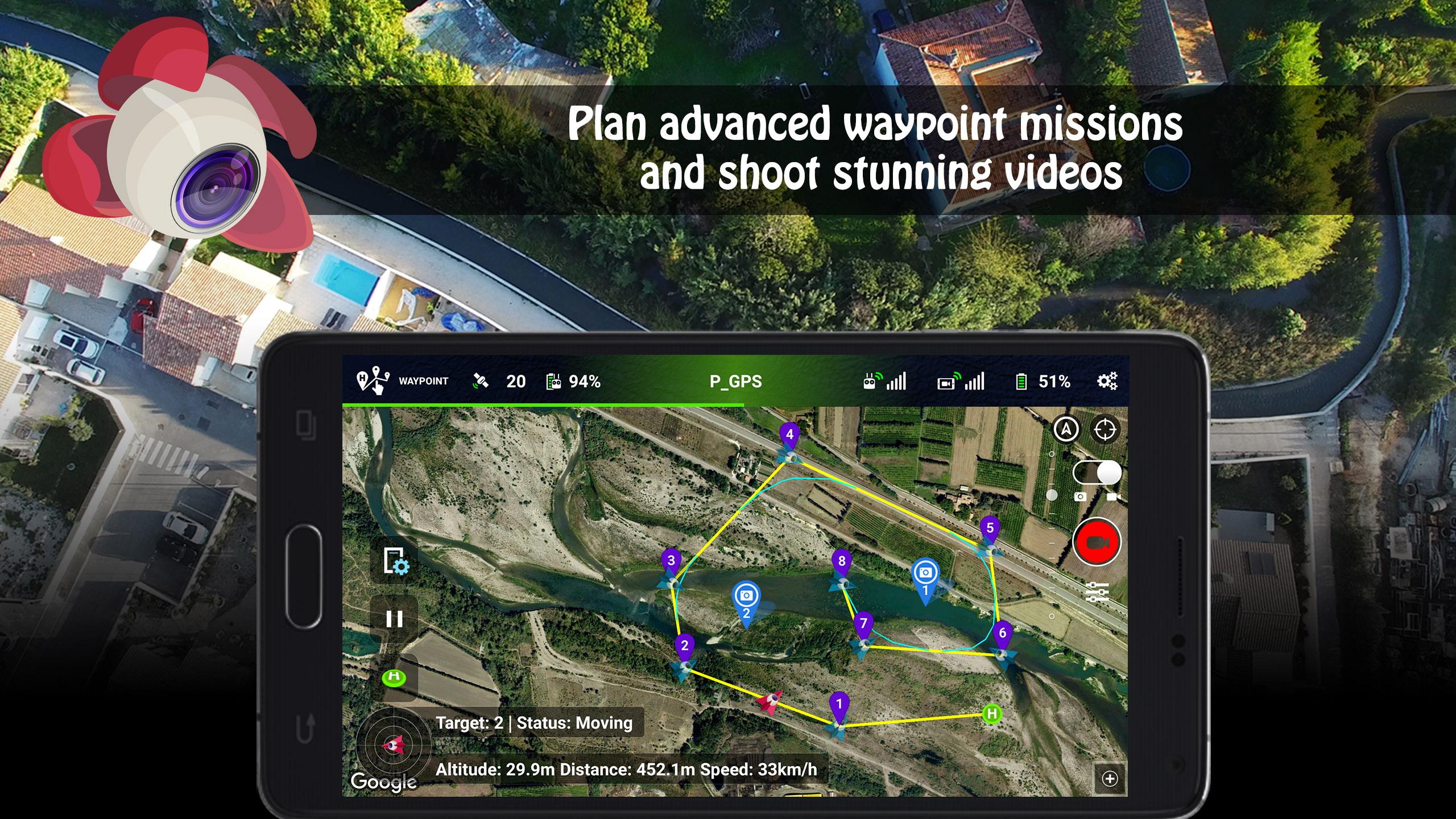
We all know that you need the official DJI GO, DJI GO 4, and DJI Fly apps to fly your favorite DJI drones, right? Wrong! There are a few alternative apps out there that can take control of your DJI Mavic Pro, DJI Spark, DJI Phantom series drone and more, the best of these apps that we’ve tried to date Litchi. The full app name is long, but explain most of what it does, Litchi for DJI Mavic / Phantom / Inspire / Spark is a robust app that maintains the same feel as the DJI apps, but it does things a little differently. Basically, if you will, if you are looking for the best of the DJI application, plus a few new treats, Litchi is well worth your consideration. The waypoint flights and VR/FPV functionality built-in are the key factors that attracted me to Litchi. Rich features and functions like these are at your fingertips through the going price of $24.99 for the app, which may be beyond what many might consider.
That’s all for today, we hope you’ve found a new app or two to enhance your flights, or get more out of the captured aerial footage after the fact. This is an early list with plenty of room to grow and mature, just like the drone market, so please hit us up in the comments if you want to discuss any other apps that you think belong here.
.jpg)
.jpg)
.jpg)